Map Projections of the Earth
Map Projections
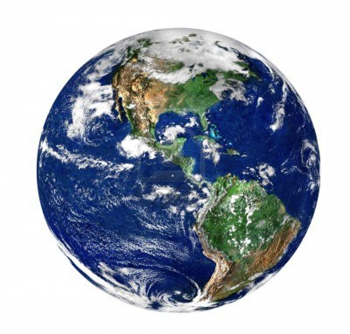
How Globes Are Made
Question 1: What challenges do cartographers face when trying to transfer the "real world" to a flat map?
Question 2: In what situations would it be better to use a globe instead of a map?
Question 3: In what situations would it be better to use a map instead of a globe?
P.S. Don't forget to use correct grammar, spelling, and punctuation!! :)
Your posts are due by Tuesday, 9/17.
Question 1: You can't fit the whole map on the flat part it only shows half the Earth it does not show the other side of Earth.
ReplyDeleteQuestion 2: A globe to see all of the Earth from the northern hemisphere to the southern and from the Prime Meridian all the way around, to the equator all the way around.
Question 3: You use a flat map to see our seven continents also for zooming in on different places.
Maps and Globes are actually pretty cool I would like to go to so many places I see on maps and the globe!
Question1: The problem is that you can't make the earth a flat image and throw it on paper .
ReplyDeleteQuestion2: You would use a globe instead of a map when your trying to find how far a state is from a state, or when looking were a county is.
Question3: You would use a map instead of a map when your looking for a specific area or a place near by.
1: A map maker has trouble making a flat map because the shapes of the continents are bigger and they changed.
ReplyDelete2: I would use a globe to find a continent.
3: I would use a map to find a hotel.
1.) Cartographers face challenges in trying to transfer the "real world" to a flat map because the earth is not flat.
ReplyDelete2.) It is better to use a globe instead of a map in this situation because it shows where things are in the world. Using the Global Information System based map shows a much larger scale.
3.) It is better to use a map instead of a globe in this situation because it shows where things are on a smaller scale. Using the Global Positioning System based map shows how to get from one place to another. An example is using the GPS in a car.
(1) There challenges are that it would be hard to make a flat map if the world isn't flat.
ReplyDelete(2) It would be better to use a globe istead of a map if you where trying to find land forms.
(3) It would be better to use a map insead of a globe if you where trying to find somewhere because it is like a gps.
1. The challenges cartographers make when trying to make a flat map s that the world is not flat and it is impossible to make everything in it 2 dimensional.
ReplyDelete2. It would be better to use a globe when you are trying to explain to a kindergartner what the world looks like and where things are.
3.It would be better to use a map instead of a globe when you are finding the distance in-between two countries while using a map scale.
1. its like an orange no matter how hard or much you push down on it it'll always come up a little.
ReplyDelete2.the globe shows you all sides of the earth and a map only shows one side of the earth.
3.to look at spacific areas on the map that are zoomed in instead of looking at a globe that has a bunch of areas that are zoomed out.
1. Trying to make the globe 2 dimensional when it is 3 dimensional creates distortion.
ReplyDelete2. Because they are more accurate than maps.
3. It is better to use a map when you want to figure out the location from one place to another place.
1. The world is not flat so it is hard to copy and show everything exactly.
ReplyDelete2. You can't see or feel the mountains on a map because they aren't raised up like on a globe.
3. You use a map so you can measure how far you have to go.
Question 1: If your trying to turn a two dimentional shape into a three dimentioal shape, it will cause distortion to the map.
ReplyDeleteQuestion 2: If you used a flat map, you couldn't see everything without distorting the size and places.
Question3: If you want to know the distance between two places. you could use a flat map.
1. If you attempt to turn a 3d shape into a 2d shape, it would cause a disortion and mess up some of the features on the map. In the example, Greenland was a huge body of land.
ReplyDelete2. A globe would be used to find what size or exact area a aspect of the earth is. Pilots prefer globes over flat maps because it lets them plan the fastest route to their destination.
3. You could use a map when you want to get a quick reference where exact detail isnt needed.
You can't make it flat because it is shaped like a sphere and it will cause distortion sometimes because if you want to see which continent or country your closest to it shows you it. A map is better if you want to see where to go for a restraint something like that.
ReplyDelete1 Question: they face distortion , and what they call the orange peel problem.
ReplyDelete2 Question: To measure the length and width.
3 Question: Maps help us identify certain places that we are looking for.
#1 The world isn't flat so in is harder to copy on a 3 demotion.
ReplyDelete#2 Because they are more accurate.
#3 You use maps to measure the distance you go.
#1: cartographers have to find a way to make a 2 dimensional form of the world.
ReplyDelete#2:if your trying to get a accurate position.
ReplyDelete#3: a map is more portable then a globe, good for traveling.
ReplyDelete#1;That cartographers are trying hard to see a world in a different way.
ReplyDelete#2;in some situation it would be better to use a globe instead of a map.
#3;If you were sailing the Atlantic ocean it would be better to use because you would some material that you cant use on a globe that you cant really use on a map.
1. They face challenges in changing a round globe to a flat map because the continents get distorted.
ReplyDelete2. A globe would be better if you are looking at countries in different hemispheres.
3. A map would be better if you are looking for directions.
#1 Cartographers have a tough time flattening the Earth because the Earth is round not flat.
ReplyDelete#2 A globe would be better to find a very precise spot.
#3 A map would be better for navigating.
1. The challenges that cartographers have is seeing the world as a flat surface instead of a round ball.
ReplyDelete2. A globe in some cases would be better to use than a map because it can help you find different hemispheres and how far away they are from each other.
3. A map is better to use in some cases instead of a globe because a map can help you see how many miles you have to go or how many left.
#1 The earth is a perfect sphere so when the crust is removed, it is not perfectly flat.
ReplyDelete#2 A globe would be better for finding a country, a continent, sea, or ocean.
#3 A map would be better for finding a state, city, capital, or lake.
#1 The earth is a sphere so when they try to make it flat it doesn't work.
ReplyDelete#2 A globe would be better for being able to see all the detailed indents and raised dents meaning for height.
#3 a map would be better for seeing which direction your going in.
Question one: One challenge is country boundaries on a political map when two countries are fighting over land.
ReplyDeleteQuestion two: Plotting a journey around the world.
Question three: Plotting a nature walk in a forest.
#1: Since the Earth is a sphere, when you make it a flat map the pieces of land become distorted and not where they really are.
ReplyDelete#2: When you are looking at very far distances and want to see the topography of the Earth, then a globe is better to use.
#3: When traveling and to find locations close to each other is when a map will be best to use.
Question 1: They have to know the world is moving and that the world is not flat.
ReplyDeleteQuestion 2: When you want to see a country or ocean easier because it's all together and not on a different map.
Question 3: When you want to see a road or landmark.
Q1: The world is round. Turning it flat does not work as easily as you would think. The cartographers would need to push down like the man did in the video.
ReplyDeleteQ2: To feel about the various mountain ranges( I love doing that ) :)
Q3: To plan where to move things.
1: When cartographers transfer locations on globes to maps, the size of the location can turn out wrong, or where it is placed.
ReplyDelete2: Globes are better than maps in cases where you are looking for countries or continents.
3: Maps are better than globes when you are looking for smaller details, like rivers, mountains, cities, states, ect.
1)the earth is not flat so flat maps do not represent actual sizes of land that are on a globe. Flat maps are only 2 dimensional. Globes are 3 dimensional.
ReplyDelete2) globes are more accurate because they are 3 dimensional. Globes represent more of the actual sizes.
3)maps can be folded and carried. Maps are lighter to hold. Flat surfaces can show distances better than globes.
1. When cartographers turn a glide into a flat map it will always cause some distortion
ReplyDelete1. Globes are better than maps if you are planning a trip around the world.
2. Maps are better if you are planning a road trip in a Smaller area.
#1 The cartographers have to find a way to make the globe 2 dimensional when it is 3 dimensional creates distortion.
ReplyDelete#2 Aglobe would be better to find a continent,seaorocean.
#3 A map would be better to find where a place is.
1)One of the things that a cartographer has to deal with is sence the world is round its hard to turn it to a piece of paper and still having all the fact s and more.
ReplyDelete2)A globe is better to see the montains and too feel it to be sure.
3)But a map is better to look very closly at something such as a small island and portible.
1) It is harder to put a map on a piece of paper, rather than to put the earth how it's meant to be.
ReplyDelete2) A situation when it would make more sense to use a globe is when you are trying spot certain landforms.
3) A situation when it would make more sense to use a map is when you were traveling or tying to spot boundaries of country's.
1(one of the things that a cartographer have to deal with is putting every country on a piece of paper.
ReplyDelete2(a globe is better because you can really see the ocean and countries.
3(when you use a map you can see rivers and cites.
Question 1: What challenges do cartographers face when trying to transfer the "real world" to a flat map?
ReplyDeleteAnswer 1: The world will never be flat no matter what.
Question 2: In what situations would it be better to use a globe instead of a map?
Answer 2: You could use a globe to see more then 1 area.
Question 3: In what situations would it be better to use a map instead of a globe?
Answer 3: To see pathways and mountain ranges.